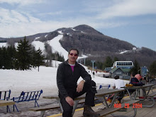
Hi All,
Get ready for some rough weather this weekend.
FYI – Hunter is expecting record crowds this Saturday based on advance ticket
sales and the hotel is sold out.
As many of you already know, Hunter North has
had two trails re-designated to “black/blue” from just “blue”. The summit
weather station wind gauge has still not been fixed.
In other news, Bear Creek has been sold and is
now closed. If you plan on dining out this weekend best make reservations. Van
Winkles in the KMC no longer accepts reservations – first come, first
serve.
Safe travels,
Jon
From the NWS:
WINTER STORM WATCH FOR THIS WEEKEND
The snow will arrive in
two phases. Light snow overnight tonight into Friday morning with a general area
of 1-2" through much of the immediate Capital District. The snow will move out
by mid to late morning. Round 2 arrives Saturday afternoon and evening with a
steadier and heavier snow expected overnight Saturday into midday Sunday. The
will be a SIGNIFICANT storm across much of the northeast on Sunday. Heavy
snowfall in addition to a region of sleet/freezing rain to rain (along the
coast). By Sunday afternoon strong winds and additional snow will result in
considerable blowing and drifting. Widespread snow fall amounts of a foot or
more is likely to the north and west of Albany with the potential for some sleet
to mix in to the south and southeast. Bitterly cold air will move in behind the
storm as it pulls away Sunday night and the snow will taper off. Temperatures
will plunge below zero Sunday night with wind chills dropping to -30 or colder.
Highs Monday will be in the single digits with wind chills of -20 to
-40.

No comments:
Post a Comment