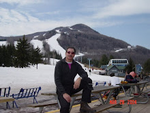
Happy B'day George Washington!
Well the huge weekend crowds are gone and we were blessed today with great skiing thanks to sun, no wind, great grooming (except Claire's) and warm temps. We had groomed corduroy ego snow again on all front side slopes and a very light crowd even with the Localmotion racers who were on the Highlands trail over at Hunter One (party at Slopes tonight). It got down to 19 overnight but now 45 as high clouds start to move in as a storm approaches. Best trail by a slim margin Cliff / Racer's which was exceptional followed by H-B-K and the entire east side which really softened under the sun. Rt 80 was also nice but the run-out at the bottom of Claire's was a bit bumpy. There was no F or D today but the quad was running well. A new lift (six-pack) to replace the quad by next ski season is looking more positive so stay tuned.......
The weather will turn nasty tonight but snow is forecast for the am and substantial accumulation for Tues night into Wed with continued snow showers through Friday. Following advisory issued out of Albany:
The weekend movie: "The Lovely Bones"
Ski Ya, http://hunterskiscene.blogspot.com/
Jon
Weather Advisories: AN ACTIVE WEATHER PATTERN THIS WEEK .
.
A series of storm systems will periods of snow and some rain this week..
Tonight a weakening storms system will approach the region from the Great Lakes as another storm approaches from the south. During the day tomorrow generally light precipitation will affect the region. Temperatures in the valleys should be warm enough to cause some of the snow to mix with light rain while the elevations above 1000 feet will see mainly snow. Accumulations are expected to be light. An in or less in the valleys with 2-3" possible in the higher elevations..
.
On Wednesday the storm to our will get better organized and a steadier, heavier snow is more likely. Once again in the Hudson Vally south of Albany will see the possibility of some rain mixing in while higher elevations in will see some heavy, wet snow. Upslope areas in the eastern Catskills and Berkshires and Southern Vermont have the potential for the heaviest amounts. The temperature profile will be critical in determining the amount of snow because of this the snowfall will be highly variable across the region..
.
By Thursday night and Friday a storm that this afternoon is near the four corners in the southwest U.S. will give us a chance of more snow and perhaps strong winds. Stay tuned....
Detailed Local Forecast
Today: Generally cloudy. High around 35F. Winds light and variable.
Tonight: Variable clouds with snow showers. Some sleet may mix in. Low 27F. Winds ESE at 5 to 10 mph. Chance of snow 70%. 1 to 3 inches of snow expected.
Tomorrow: Occasional snow showers. High around 30F. Winds E at 10 to 15 mph. Chance of snow 70%. 3 to 5 inches of snow expected.
Tomorrow night: Snow likely. Low 27F. Winds NE at 10 to 15 mph. Chance of snow 80%. Significant snow accumulation possible.
Wednesday: Snow early. Highs in the low 30s and lows in the upper 20s.
Thursday: Chance of a few snow showers. Highs in the upper 20s and lows in the mid 20s.
Friday: Periods of snow. Highs in the low 30s and lows in the mid 20s.
Monday, February 22, 2010
Subscribe to:
Post Comments (Atom)

No comments:
Post a Comment