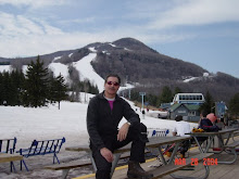
It's HUNTERADO!! Yes folks, it is like skiing in Colorado here at Hunter today and for the rest of the week. We are getting blasted with wind driven snow out of the east at the rate of 2 - 3" per hour and there are no people here to ski it off - freshies every run. The visibility can be very tough at times as there is also some fog drifting around the top of the mtn. The temp is mid 20's at the top and about 30 at the base. The roads are all white and no plows yet. No F or D again but who needs them! All trails are perfect including Claire's & Racer's top to bottom and I skied them all except Apurna which I don't trust. Since it was so warm yesterday the base softened so there is no ice under a layer of creamy powder. I must say it was alot of fun today. If any of you have extra days to take off, do it this week - tomorrow will be a POWDER day! We are in the 10-15" band per the forecast warning out of Albany - click on the link that says "click here for latest snow accumulation forecast"
Ski ya,
Jon
http://www.cbs6albany.com/sections/weather/7day/
Meteorologist: Steve LaPointe
Last Updated: Tuesday, February 23, 2010 12:55PM CLICK HERE for the latest Snow Accumulation Forecast Weather Advisories: WINTER STORM WARNING now in effect through 7pm Wednesday for eastern New York and western New England. Heavy to major snow accumulations are likely across the region tonight through Wednesday with the inbound storm. Snow will be very wet and heavy which potentially will lead to some tree and power line damage beginning late tonight and continuing through Wednesday. Scattered power outages will be possible with this storm.
.
Low pressure currently developing south of New England will continue to channel moisture into eastern New York and western New England this afternoon. Marginal temperatures through the mid afternoon hours will preclude much in the way of snow accumulation through the day. However, towards, evening, as precipitation rates increase in combination with some lower level cooling, snow will begin to accumulate more rapidly. Heavy snowfall rates are likely tonight into Wednesday leading to low visibility and hazardous travel conditions..
.
Storm accumulations in excess of 15" are likely in the higher elevations of the Catskills, Adirondacks, and Green Mountains in Vermont. Storm accumulations of 12" are likely throughout much of the remainder of eastern New York and western New England..
.
Snow will become lighter and more intermittent Wednesday afternoon, tapering to flurries or drizzle by the evening.
.
.
Thursday into Friday Event Another storm is likely to form out of the blocked weather pattern Thursday or Thursday night. As this potential system is further out in time, and linked to how all the weather before it plays out, it remains quite uncertain as to how it will evolve and therefore impact the local area with additional snowfall. However, another round of significant snow is possible for the region during this period. Stay Tuned!.
Detailed Local Forecast
Today: Cloudy with snow. Temps nearly steady around 30. Winds E at 10 to 15 mph. Chance of snow 80%. 1 to 3 inches of snow expected.
Tonight: Periods of snow. Low 28F. Winds NE at 10 to 15 mph. Snow accumulating 6 to 10 inches.
Tomorrow: Snow during the morning will transition to snow showers during the afternoon. Temps nearly steady around 30. Winds N at 10 to 15 mph. Chance of snow 80%. Snow accumulating 3 to 5 inches.
Tomorrow night: Cloudy with snow showers developing after midnight. Low near 25F. Winds WNW at 5 to 10 mph. Chance of snow 60%. Some snow accumulation possible.
Thursday: Snow and windy. Highs in the low 30s and lows in the mid 20s.
Friday: Snow. Highs in the upper 20s and lows in the mid 20s.
Saturday: Chance of a few snow showers. Highs in the low 30s and lows in the low 20s.
Tuesday, February 23, 2010
Subscribe to:
Post Comments (Atom)

No comments:
Post a Comment