Hi All,
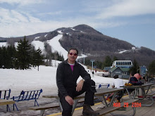
Skiing was great today!! The wind was gone, the sun was out at least until about 1pm, and the temps warmed from high teens to now 35. The mtn was very empty and the grooming again superb combined with the fact that the wind had blown fresh powder all over the mtn last night. The entire front side was excellent including Racer's which was not groomed. The best run however was to be found on Claire's which was groomed top to bottom and stayed fresh all morning. Rt 80 was also quite nice.
The big story of course is the weather for tomorrow and I will quote you below the latest from the national weather center out of Albany which seems to suggest a more northerly track which could bring us a good foot of snow.
Regarding the quad: I was told by a very reliable source that a decision may be made as soon as Feb 15 (for installation by August1st) for a six-pack from POMA to replace the quad and a reconfiguration of the quad for use on the west side. They have been seeking financing for this project. Stay tuned..........
I forgot to mention that last Friday the head of the ski patrol, "Red" took a bad spill at the bottom of lower crossover and tore up both a knee and a hip. Xrays for breaks were negative but he is waiting for MRI tests to determine the extent of the ligament and tendon damage.
Ski ya, http://hunterskiscene.blogspot.com/
Jon
Weather Advisories: MODERATE TO HEAVY SNOW STORM MORE LIKELY AS OF THIS UPDATE FOR A LARGER PORTION OF THE REGION.
.
WINTER STORM WARNINGS now issued for Greene, Columbia, Ulster, Dutchess, Otsego, Delaware, Berkshire and Litchfield counties from 5am Wednesday to 1am Thursday where snow accumulations ranging from 6"-12" are increasingly likely.
.
Early afternoon trends are now suggesting Wednesday's coastal storm will develop and track somewhat further north along the New Jersey coast. That coupled with rapid development will create a band of heavy snow to the north and west of the low center. With a more northward position along the coast, the potential for that heavy band of snow to developed into the Catskills, Mid Hudson valley, Berkshire and Litchfield counties has increased. North into the Capital Region, Mohawk valley, and southern Vermont a borderline line to moderate snowfall, with a light snowfall in the Adirondacks..
.
Terrain will likely play a key role in snow accumulations with significant upslope enhancement likely in the eastern Catskills, Litchfield hills and Berkshire County. East facing slopes in these regions potentially will see in excess of 12" of snow from the storm..
Thursday: A few snow showers possible, windy. Highs in the mid 20s and lows in the upper single digits.
Friday: Partly cloudy. Highs in the low 20s and lows in the upper single digits.
Saturday: Snow showers at times. Highs in the low 20s and lows in the low teens.
Tuesday, February 9, 2010
Subscribe to:
Post Comments (Atom)

No comments:
Post a Comment